Capture the King Tide!


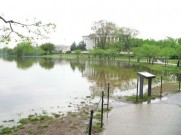
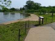
A King Tide is the naturally occurring extreme high tide, which happens once or twice a year due to the alignment of both the sun and moon’s gravitational pull. During this time, there can be flooding not usually seen during daily high tides. As sea levels continue to rise due to climate change, this unusual flooding brought during the King Tide will become common as tides continue to rise and fall under an elevated sea level. Although not caused by sea level rise, the height of a King Tide gives us an idea of what the average high tide level might be in 20-30 years.
The Long Island Sound Study is participating in the King Tide campaign in an effort to help communities and individuals visualize the impacts of sea level rise. And we need your help!
Here’s how you can “Capture the King Tide”:
- Pick a site! Choose a site around Long Island Sound that is easy to access during high tide. (Please remember to exercise caution and do not go to areas where dangerous conditions exist!)
- Know the tides! Determine when the high tide will be for the daylight hours of Oct. 19 or 20 (for comparison) and the daylight hours of Oct. 26 or 27 (the King Tide!). You can do this by using the tide charts on the following websites:
Connecticut tides and New York tides - Capture the King! Take photos of your site during HIGH TIDE and daylight hours of Oct. 19 or 20 (for comparison) and Oct. 26 or 27 (the King Tide!). IMPORTANT: Make sure the photos are taken from the same spot (or as close as possible) so we can be compare the water levels among the dates!!
- Show us your stuff! Submit your photos, along with the time and date each photo was taken, to info@longislandsoundstudy.net or post them to our Facebook page by Nov. 4. Selected photographs will be posted to the Long Island Sound Study’s website in early December!
Of course, feel free to contact Larissa at 631-632-9216 or LJG85@cornell.edu if you have any questions!


For more information on tide predictions, visit NOAA’s tides and currents website. To learn more about the King Tide visit the Washington State Department of Ecology’s climate change website.