Sound Stories
The blog of the Long Island Sound Study
The blog of the Long Island Sound Study
(Charlotte also produced a video of her experience, available on YouTube)
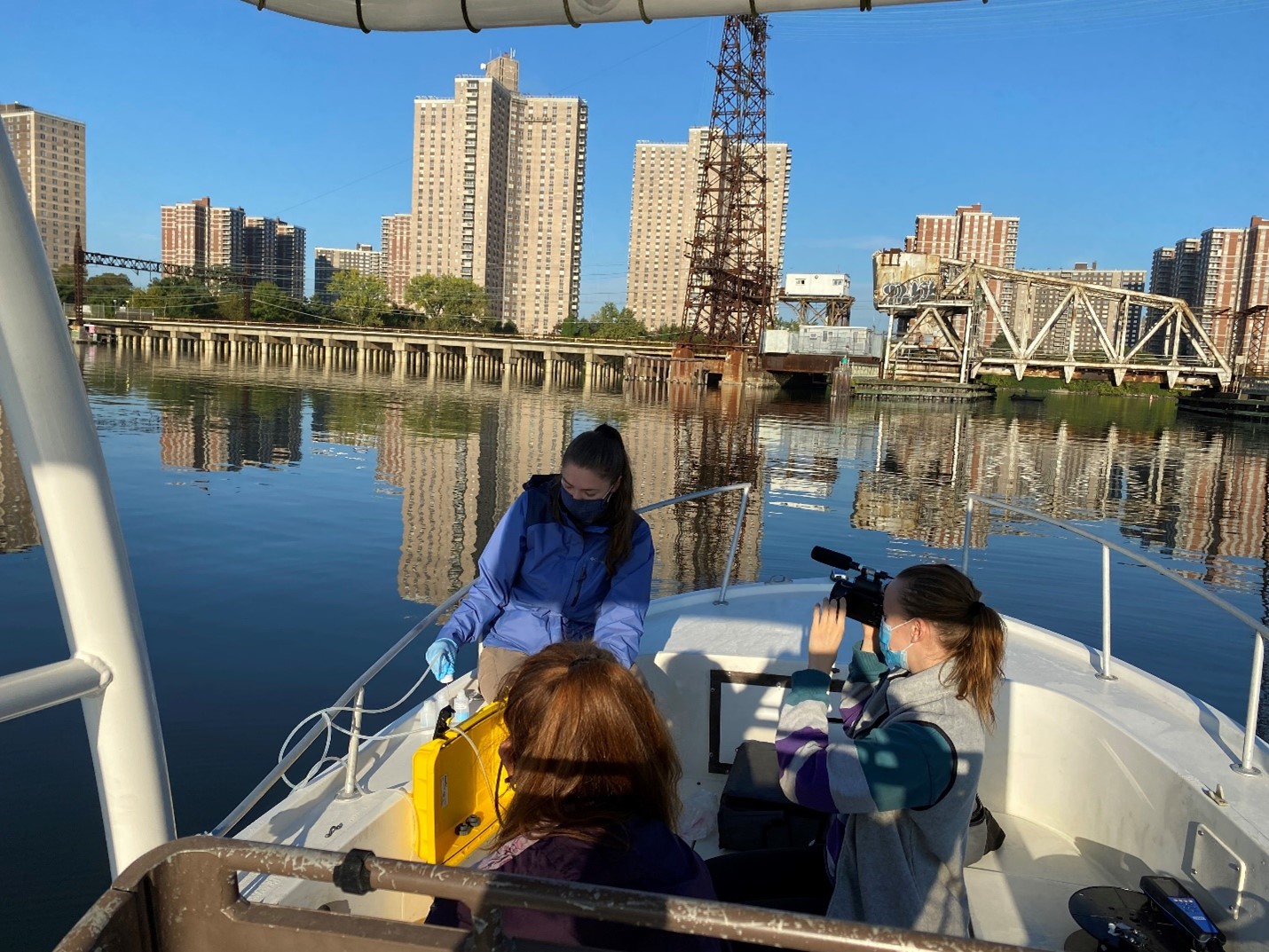
I can’t remember the last time I saw a sunrise. Soft yellow, bright orange, a hint of pink against the beginnings of a bluebird sky. Today is the perfect day to be out on the water.
I’m tucked onto the tiny, peeling bench of a speed boat next to Elena Colon, an Environmental Analyst for Save the Sound. My camera is strapped to my hand but Elena eyes it warily. “Be ready with that camera, I don’t want it to fall off your hand.” I opened my mouth to reply but we’re already off, boat (and me) bouncing along the wake. Jenna Morrissey, an environmental technician for Save the Sound, and her plus one, her mom, are sitting in the front, water sampling equipment secured at their feet.
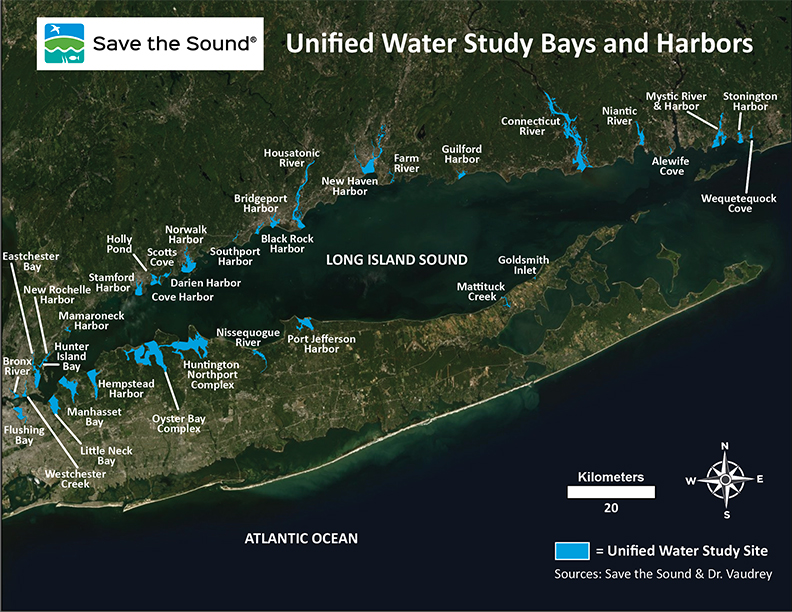
At 6 am on Oct. 15, 2021, I joined Elena and Jenna on one of their weekly water quality sampling trips in Eastchester Bay in the Bronx. This sampling is part of the Unified Water Study (UWS), a standardized water sampling protocol carried out by a network of community groups and organizations in bays, inlets, and harbors around Long Island Sound. The program is managed by Save the Sound and it was officially launched in 2016. Before then, some local groups did their own water quality monitoring around the Sound, but each had their own procedures. Since people were collecting data differently across the board, it made sharing and comparing data pretty difficult.
Over ten years ago, resource managers and partners at the Long Island Sound Study (LISS) began to identify this need for more coordinated monitoring of the Sound’s bays and inlets. They explored the idea of establishing a community-led program to do it and tasked Save the Sound with developing a program for water quality testing. So, with the support of the Long Island Sound Study, the Unified Water Study as we know today was created.
Back in the boat, I yawn behind my mask flapping in the wind. “Why so early?” I ask Elena. Apparently all the UWS groups have to sample within 3 hours of sunrise because dissolved oxygen (DO) levels in the Sound naturally sink lower in the night than the day. Even though these dips are natural because of reduced photosynthesis, it’s important to know how low those lows are. Overly low dissolved oxygen means hypoxia, which can lead to fish and other aquatic organisms dying off. Ideally, she said, it would be best if they sampled at night to get the most accurate DO reading, but that wouldn’t be too safe!
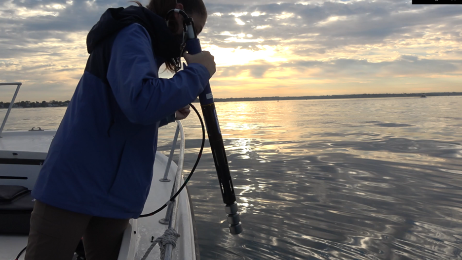
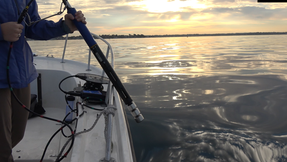
Before I can have too much fun as the speedboat races across the water, we’ve stopped at our first station. Jenna calibrates the sonde — an instrument that measures dissolved oxygen, salinity, temperature and more — then drops it off the edge of the boat where it slips easily into the placid water. It’s quiet except for Elena reading out coordinates to Jenna’s mom who is today’s scribe. Watching Jenna hoist the Sonde in and out of the water, I ask Elena what they’re sampling. “Tier 1 and Tier 2!” she says.
The Unified Water Study has two sampling ‘tiers’. Tier 1 focuses on collecting turbidity (water clarity), dissolved oxygen , salinity, temperature, and chlorophyll a (the stuff that gives plants their green color) data, as well as qualitative macrophyte surveys called rake tosses (which are not happening today sadly). Macrophytes are large aquatic plants that grow in order near to water. Every group collects Tier 1 data. Some groups also do Tier 2 sampling, which includes collecting water samples for nutrient analysis, quantitative macrophyte surveys, and continuous data loggers that collect DO, salinity, and barometric pressure data every 15 minutes.
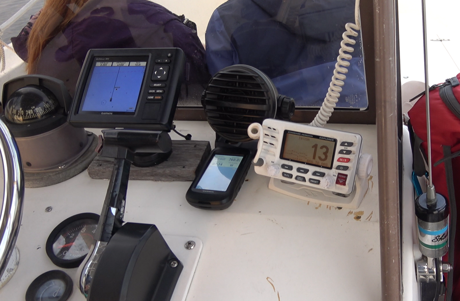
As we move on to the next station, Elena pilots the boat with ease as I bombard her with questions. Most importantly, I want to know how they make sure that the data they collect is trustworthy. She tells me that the parameters that the UWS measures were carefully chosen through their EPA-approved Quality Assurance Project Plan, or QAPP. The QAPP is basically a guide detailing how to collect the water monitoring data along with other quality assurance measures. An important part of the Unified Water Study QAPP are calibrations that occur within 24 hours of sampling. This involves placing the Sonde in standards of known value to check the validity of its sensors. In the end, even if the data is collected, it can’t and won’t be used if it isn’t trustworthy, Elena stresses.
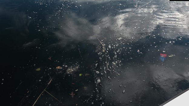
While Elena and I are talking, Jenna points out some gooey, dark green bubbles at the surface of the water. While they may not mean anything, Elena says, they might be indicative of excess algae. Elena elaborates saying chlorophyll a (along with dissolved oxygen) is an important indicator of the amount of nitrogen in the water, one of the biggest pollutants facing the Sound. Chlorophyll a is a substance found in plants and algae that gives them their green color and is representative of algae or plant matter within water. If nitrogen is abundant in a water source, the phytoplankton and algae in the water begin to grow out of control and use up the oxygen, which leads to low levels of oxygen in the water (hypoxia). This whole process is known as eutrophication.
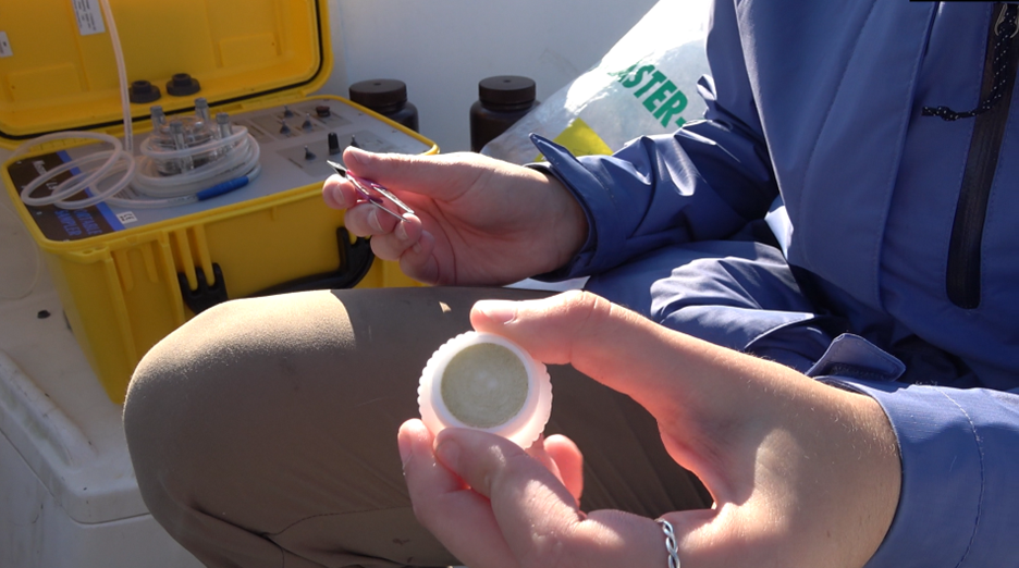
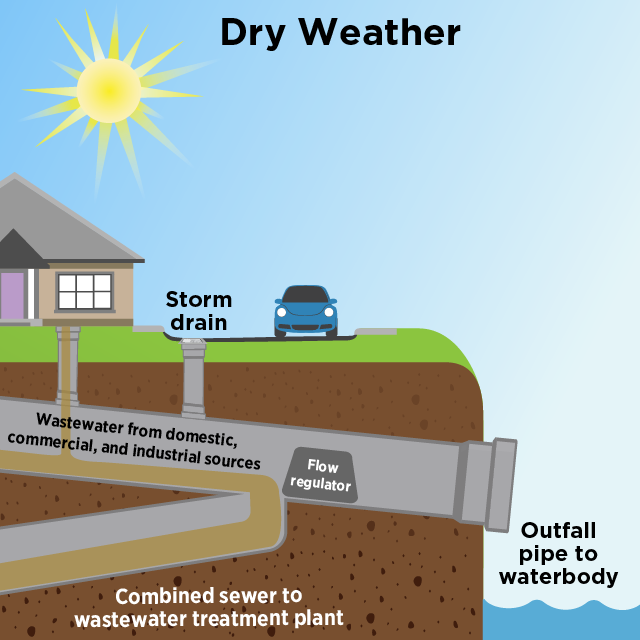
But how does nitrogen even get into the Sound? From my own experience sampling water in the Hudson River, nitrogen enters the Sound through sewage overflows as well as tributaries and rivers. It had rained heavily the days before I collected samples from the Hudson and I came face to face with the impacts of combined sewer overflows, which are a huge problem for New York City and the surrounding area. Since NYC has a combined pipe system for commercial and residential sewage as well as regular wastewater, when it rains heavily, this system can overflow. Luckily the system has outfall pipes, but unluckily, they dump the excess sewage directly into the Hudson, East River and the Sound. [JBPV1] Nitrogen also enters the Sound through groundwater, rivers and tributaries that are themselves inundated with nitrogen. The source is commonly old, failing septic systems, but excess fertilizer used on lawns and crops also contributes.
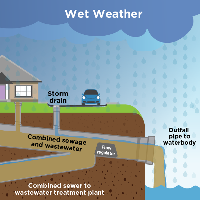
Apart from the smell, how would you know that sewage was just dumped into the river? This is why water quality monitoring and data collection is so important. Imagine turning on your tap and your water is sludgy brown. Wouldn’t you like to know what’s going on? Data collection can help guide scientists towards the cause of such a problem, and more importantly, the solution. It can also help researchers to understand what they are doing right and how to keep that up. Trustworthy data can also lead to support and funding for projects intended to improve water quality further in the future.
Once a baseline for a body of water or area is established, any impacts of restoration or rehabilitation projects can be assessed against that baseline. This kind of targeted data collection is important. The UWS was essentially created because the bays, inlets, and harbors around the Sound are pretty different from the open Sound waters. These areas are heavily impacted by people and experience a greater variety in depth, current, and nutrient content, which are all factors when thinking about water quality.
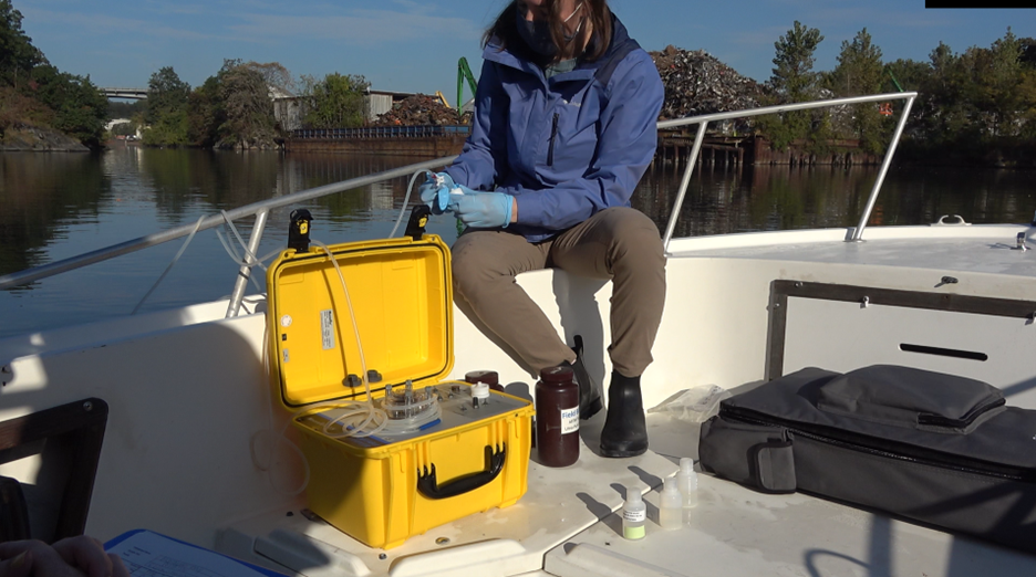
After we pulled back into the dock, Elena showed me how to tie up the boat (it’s harder than it looks!). Then we parted ways. While I headed back into the bustle of the city, Elena and Jenna went upstream to collect water quality data from the Hutchinson, the river that empties out into Eastchester Bay. After that, Elena will go back to the lab, calibrate her instruments, and analyze the data for quality assurance. Next year, the data collected on this trip will be used in the Long Island Sound Report Card, a publication that details the health of the Sound’s waters. What’s interesting is that each bay, harbor, or inlet gets a grade based on the quality of the water. I noticed that Eastchester received an F last year. Though it’s definitely not ideal to get the lowest grade in the book, this means that the Unified Water Study has identified a problem here, which can help scientists and government officials look for a solution.
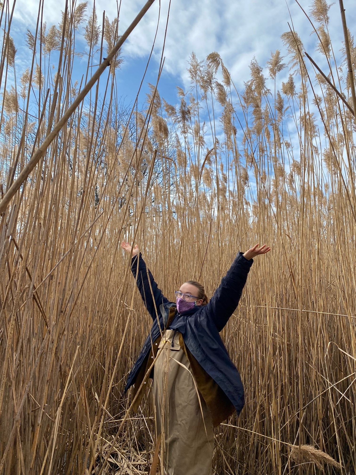
Charlotte Burger worked as a Science and Education Communications Intern with New York Sea Grant in 2021. She graduated from Barnard College in 2022 with a degree in Environmental Science and now works as an Environmental Engineering Consultant at NV5. Charlotte’s senior thesis focused on evaluating the success of eelgrass restoration around Long Island Sound. When she’s not working, you can find her on long walks in Central Park, dabbling in science fiction writing, and making cool maps using GIS.
Notifications