Bringing a Community-based Monitoring Network to the Sound’s Bays and Harbors
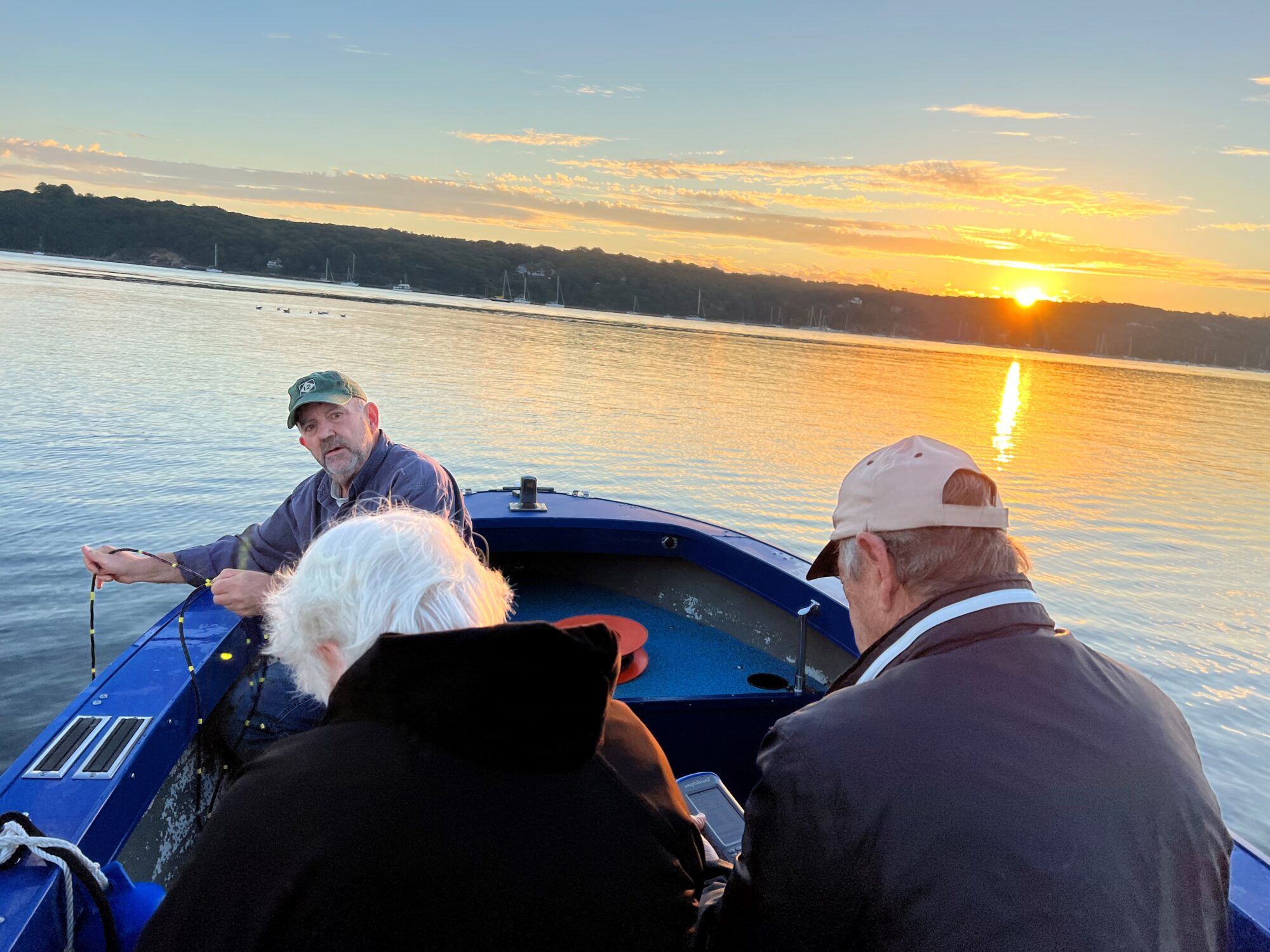
Every 10 days from mid-spring to mid-fall George Hoffman gets up early in the morning to meet three of his colleagues with the Setauket Harbor Task Force. At the harbor around 5:45 am, they join the captain of a small boat who takes them out on the water to monitor the ecological health of Port Jefferson and Setauket harbors.
Rain or shine, these volunteers navigate by GPS to their designated water quality stations to measure the water quality of their part of Long Island Sound. They take readings with a monitoring probe called a multiparameter sonde to help detect whether the impact of pollution from excess nutrients entering coastal waters as well as warm temperatures can lead to algal blooms and declines in oxygen. Low dissolved oxygen levels can result in hypoxia, or anoxia (no oxygen at all), making it difficult or impossible for fish and other aquatic life to breathe. Algal blooms can block the sunlight needed for eelgrass, an important underwater grass, to grow. Some harmful algal blooms can even be toxic to wildlife, humans, or pets.
In six years of monitoring, Hoffman recalls the task force members only missing one or two days of monitoring—due to heavy fog. The early morning alarm for monitoring–a requirement of the UWS that monitoring be conducted within three hours of sunrise when hypoxia is easier to detect—has not been a barrier for participation.
“People love to be out on the water and the earlier the better,” said Hoffman. “I thought at 5:30, 6 o’clock it would be a problem, but I never had anyone quit.”
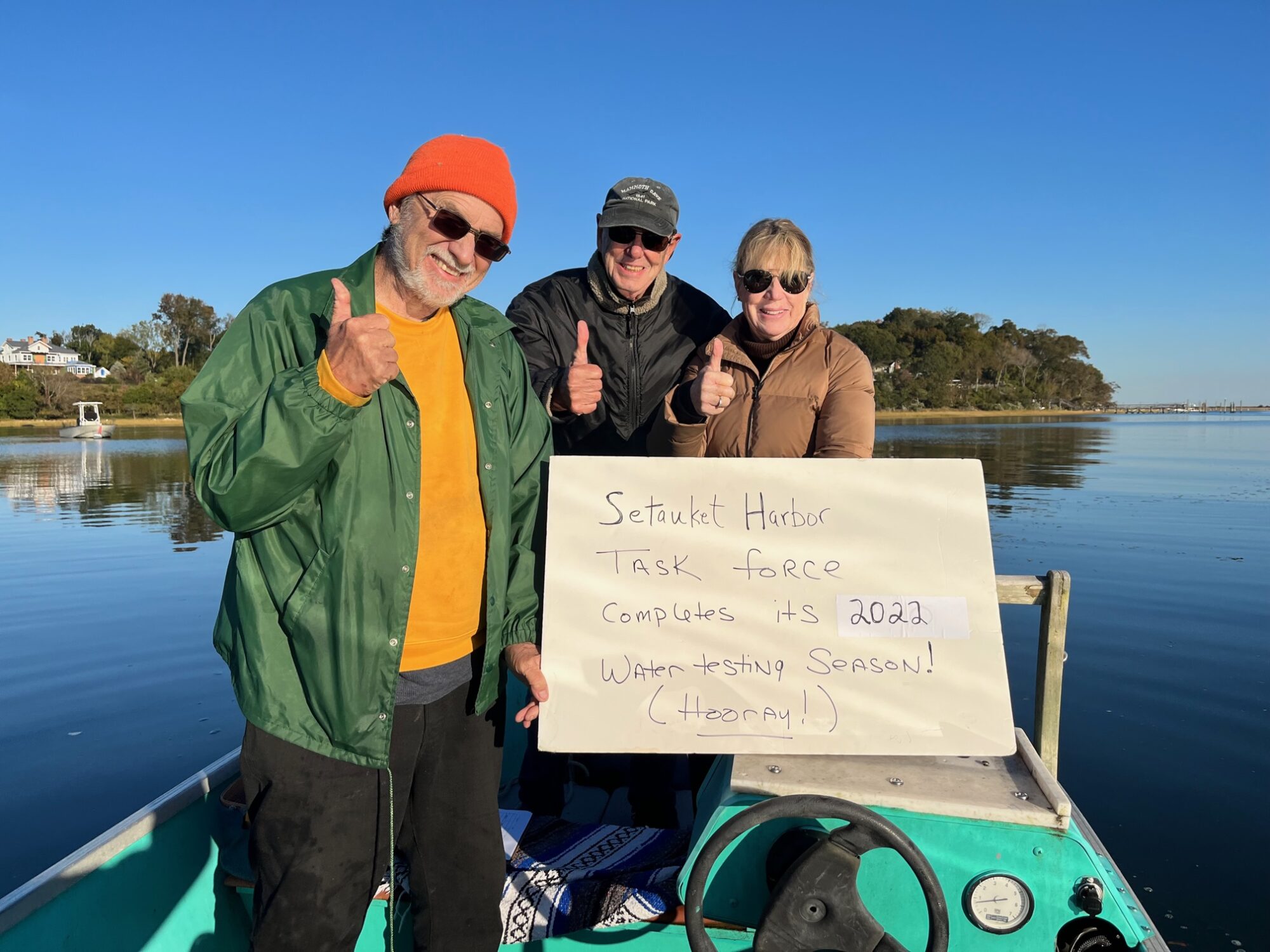
Dedicated volunteers are not unique to Setauket and Port Jefferson harbors. The local group is part of the Unified Water Study, a soundwide monitoring program established by Save the Sound and financially supported by the Long Island Sound Study through the U.S. Environmental Protection Agency. Since the UWS was created seven years ago as part of a handoff of a project called the Long Island Sound Report Card, it has grown into the largest community coastal water quality monitoring program on the Sound, and probably one of the largest in the northeast.
“I think what’s important about being a participating organization in the monitoring is that it really has given us a lot of credibility in terms of dealing with our local governments,” said Hoffman, a semi-retired legislative and local government official who helped start the task force in 2015 with a mission to reduce harmful bacteria in Setauket Harbor so that shellfish could once again be harvested. The task force has since expanded to include water quality issues related to the Unified Water Study. “I think a lot of people know that this is a large community of (groups) doing this on harbors on both sides of the Sound.”
Hoffman said the group’s ability to collect quality data has helped them gain the respect of local, state, and federally elected representatives, who in turn have helped to secure grants for public works projects to reduce the amount of polluted stormwater runoff entering the harbors. The Task Force is particularly concerned about polluted runoff and sediment from stormwater and sediment originating from Route 25A, a heavily used road near the shoreline.
The early morning alarm for monitoring–a requirement of the UWS that monitoring be conducted within three hours of sunrise when hypoxia is easier to detect—has not been a barrier for participation in Setauket, Port Jefferson or elsewhere.
“People love to be out on the water and the earlier the better,” said Hoffman. “I thought at 5:30, 6 o’clock it would be a problem, but I never had anyone quit.”
Since its 2016 start as a pilot project with three groups, the UWS has grown to 27 groups, ranging from all volunteer organizations like the task force to local government organizations and the Interstate Environmental Commission. The groups will monitor 46 embayments in 2023. Around the Sound, these water bodies have several names, including bays, harbors, coves, and inlets, and are associated with local references, such as Setauket Harbor, in the hamlet of East Setauket in the Town of Brookhaven on Long Island and Scott Cove in Darien, Connecticut.
As participating organizations under the UWS, programs like the Setauket Harbor Task Force agree to collect the same data using the same procedures through a Quality Assurance Project Plan. The QA plan is a requirement by EPA to receive federal funding, but it is also designed to assure that the data are scientifically trustworthy and can be used by decisionmakers. While the program’s data is standardized, each of the participating organizations have their own unique reasons to monitor their local waters.
Some of the local monitoring programs participating with the Unified Water Study have existed for decades. Many, such as the Coalition to Save Hempstead Harbor, and Harbor Watch, which monitors waters in Norwalk Harbor, have been collecting data that have led to successful efforts to reopen shellfish beds and remove sources of bacterial contamination. But prior to the UWS there has never been a regional approach to studying some of the most vexing problems affecting coastal waters, including the role nutrients play in impacting oxygenated waters.
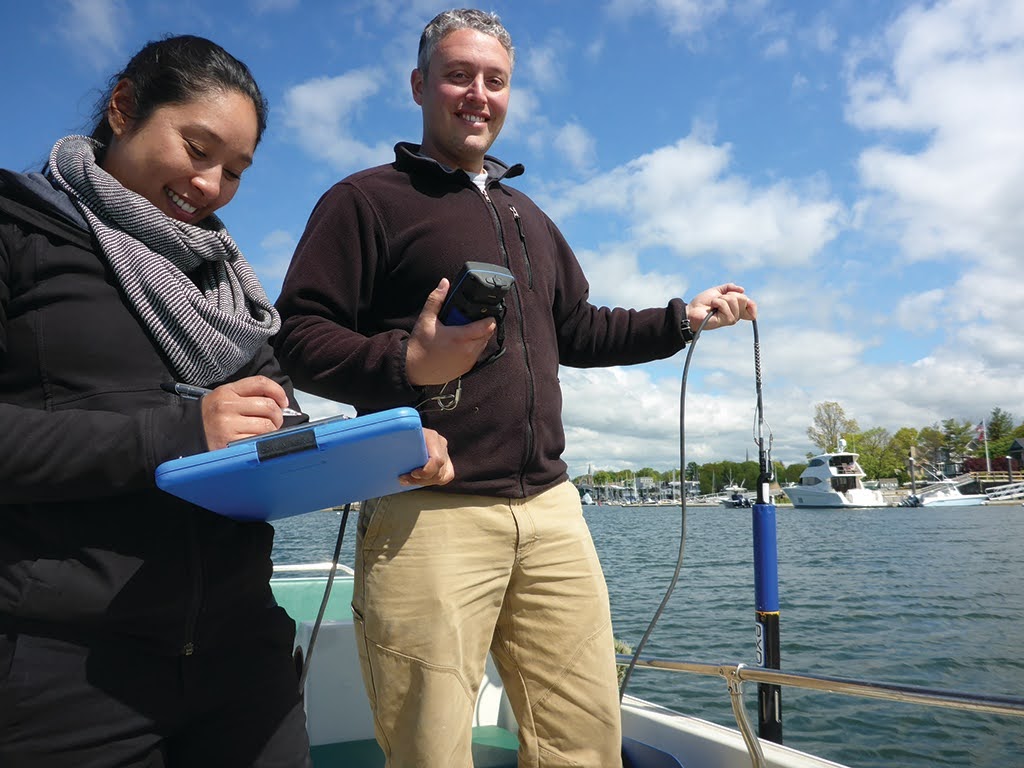
“Nothing to this scale has everyone out in the water, same time in the morning, and using the same instruments, using the same standards collecting very important environmental health metrics, including dissolved oxygen,” said Peter Linderoth, Save the Sound’s water quality director, and its manager for the UWS since its start. “Just like we need oxygen to breath, animals in the water need oxygen.”
In contrast to the near-shore waters, the Long Island Sound Study has been funding coordinated efforts to monitor water quality in the “open water basins” and “narrows” of the Sound from New York City to eastern Connecticut and Long Island since 1987. Water quality data from that effort as well as from New York City were used by LISS, EPA, and the states of Connecticut and New York to help develop a plan to reduce nitrogen discharged from wastewater treatment plants. Water quality monitoring of the open Sound is ongoing in order to track the response of the nitrogen reduction plan as well as track other impacts, including increasing water temperatures, to the health of the Sound.
For the public and for policy makers, the results of the Unified Water Study monitoring efforts are available through the Long Island Sound Report Card, a project Linderoth works on with a team of scientists and UWS staff, and which is supported through The John and Daria Barry Foundation. Nearly a decade ago, Save the Sound took on the biennially produced report card from the Integration and Application Network, a program of the University of Maryland Center for Environmental Science. IAN had received funding from the Long Island Sound Funders Collaborative to use existing water quality monitoring data to provide a report with letter grades to make it easier to evaluate the effects of restoration, conservation, and management on the Sound’s ecosystem. The letter grades were modeled after a similar report IAN developed for Chesapeake Bay and has since been replicated around the world. The initial report IAN produced for Long Island Sound with 2013 data focused on the Sound’s open water basins, but IAN also included grades for two bays as a model for future reports to have an expanded section for bays. When Save the Sound took over, however, it decided at first to remove the bays from the report card, and instead focus on creating and growing the Unified Water Study.
“(When) we became the group that releases the Long Island Sound Report Card we almost immediately took the embayments out of the report card and stopped extending the open water grades into bays and harbors,” said Linderoth. “We knew and know still that those waterbodies are incredibly relevant to the neighborhoods that surround them and to the communities that surround them, not just the specific neighborhoods. So, we needed to generate high quality comparable data to fuel bay grades for those bays and harbors because we see them as an incredibly important part of Long Island Sound of course and to really relay their conditions to lay people we needed to improve our monitoring program to get data to fill those gaps.”
The first report card with bay data was for 2020. Of the 50 bays and bay segments monitored by 22 groups, 56 percent received a grade of C, D, or F, and only six received a grade of A. The report highlighted the outsized impact that pollution from communities have on coastal waters, especially where tidal exchange from the ocean-influenced open Sound is low and pollutant loads from the rivers and streams are high. The grades showed that hypoxia was the biggest problem followed by excessive macroalgae or seaweed, a companion stressor.
Elected officials took notice. The report card played a role in congressional efforts to increase funding for Long Island Sound’s restoration. After the report card was released in October 2020 Connecticut Senators Richard Blumenthal and Chris Murphy cited the findings that more than half the bays received “low water quality scores” when it delivered a letter to the Committee on Appropriations and the subcommittee on Interior, Environment and Related Agencies that called for a “request for robust funding” for Long Island Sound.
As for the Long Island Sound Study, the Unified Water Study has helped to accomplish a long-term goal for developing a soundwide embayment monitoring network. In 2011 that became a priority when the LISS Management Committee requested proposals from scientists to evaluate existing embayment monitoring programs and provide recommendations on how to develop the network. At the time, the LISS management and scientific committees were seeking more information on the sources of nutrients coming from coastal lands that impacted the near shore, but also the open waters of the Sound. They desired to “improve access by Long Island Sound Study (LISS) partners’ to quality-assured embayment water quality monitoring data, and ultimately to improve scientific understanding for a more holistic management of the Sound.” The LISS committees also recognized the need to address pollution in the near-shore areas that had the most immediate impact on communities, including through beach closures, shell fisheries closures, and nuisance algae blooms. The resulting report, published in 2013, called for creating new water quality monitoring positions to help develop the network. It also included a proposed budget, but there were no funds at the time to implement the network.
Fast forward to 2023, and the data collected through the Unified Water Study is being used by Long Island Sound Study’s partners. CT DEEP, for example, is using data to assess whether near shore areas are meeting the state standards for dissolved oxygen levels. Data from the near shore areas through the UWS also will be used to supplement CT DEEP’s data collection effort designed to develop scientific models for establishing new targets to reduce nutrients in Connecticut’s priority bays and harbors. CT DEEP anticipates that once the models are completed and corrective actions are implemented, the frequent monitoring of bays by the UWS groups will also be valuable to help track the response of the system to change over time.
Kelly Streich, a CT DEEP analyst working on the model, said that having a quality assurance plan was essential for the state’s ability to use data collected by community-based organizations.
“That makes a big difference.” said Streich. “We know it is quality assured, we know that the UWS monitoring groups were trained, and the data is validated through the UWS program before it is made available for use by Save the Sound.”
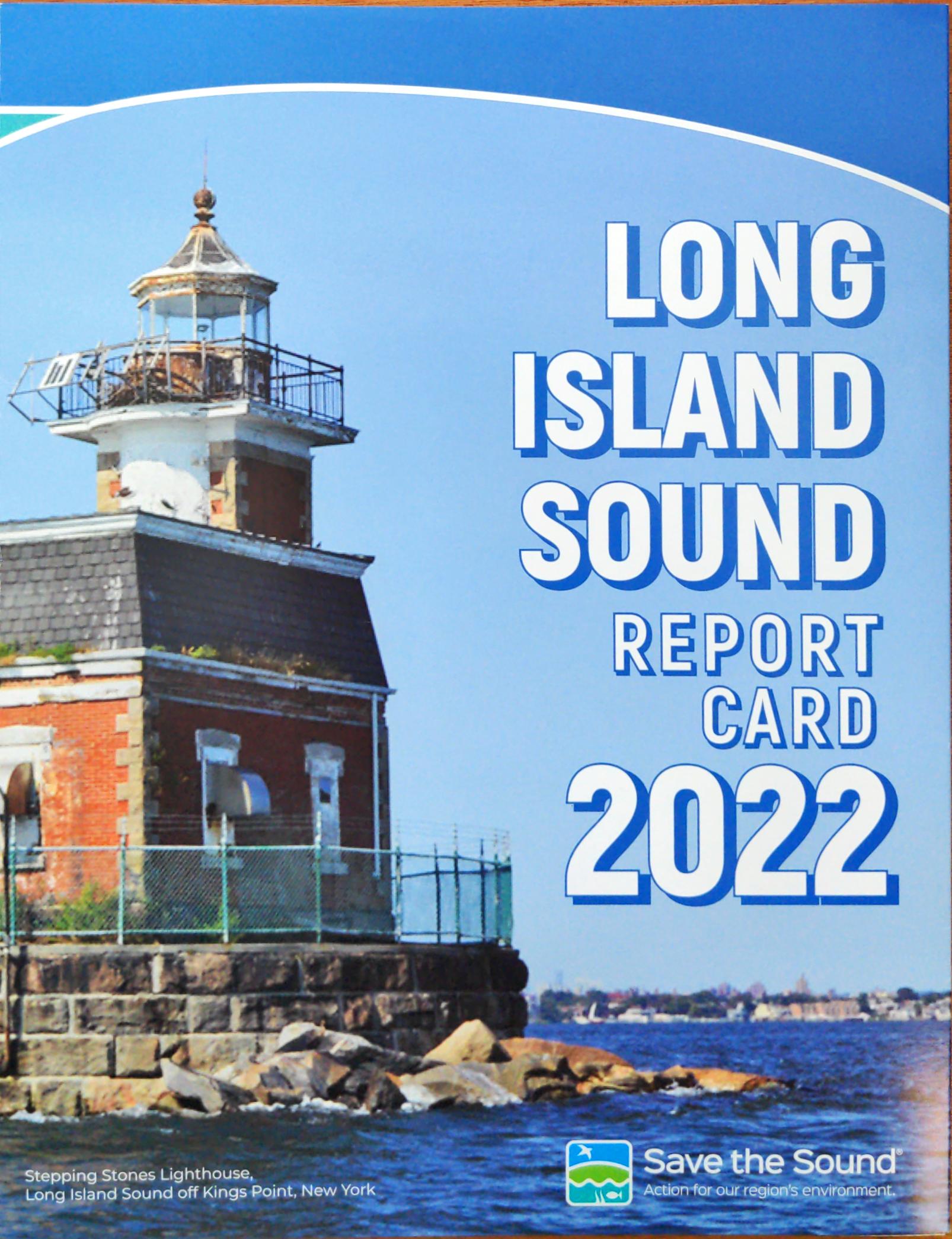
You can request the 2022 Long Island Sound Report Card, and download previous report cards, on the Save the Sound website. Long Island Sound Report Card – Save the Sound