Water Quality Monitoring in the Sound and Embayments
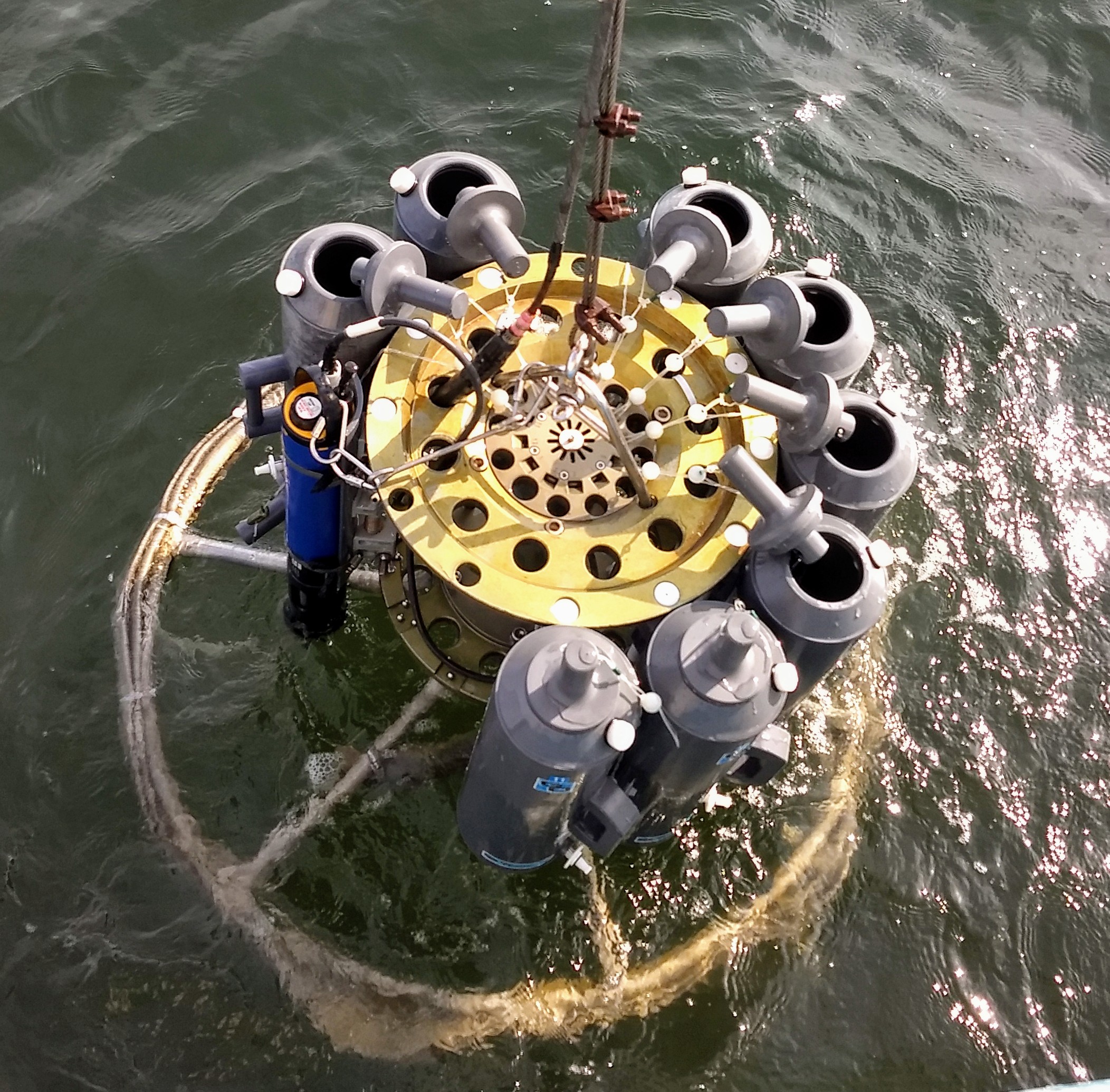
A rosette sampler being dropped into Long Island Sound from the CT DEEP Research Vessel John Dempsey. The circle of water bottles collects water from surface and bottom depths of the Sound for later analysis.
Overview
Across Long Island Sound water quality is monitored by state, interstate, and local agencies, academic institutions, environmental Nongovernment Organizations, and local volunteers and community groups. Typically, community organizations focus on rivers, bays, harbors, and inlets, while the open Sound is generally monitored by governmental agencies and universities.
Monitoring consists of measuring and analyzing physical, chemical, and biological components of the Sound’s water and sediments, and its marine and plant life. Physical measurements such as temperature and salinity of water can be used to track water mass movements, which, along with levels of dissolved oxygen can indicate how suitable a particular area is for marine life. Chemical analyses of sediment and animal tissue can reveal what chemicals are present, including toxic chemicals, while data from testing of animal tissue (particularly of non-migratory organisms, such as mussels) also can be used to assess the extent to which organisms absorb contaminants.
Biological measurements, such as measuring the presence or absence of certain animal and plant life, as well as their relative numbers with respect to other organisms, also helps indicate water quality.
Monitoring can be conducted at regular sites on a continuous basis (“fixed station” monitoring); at selected sites on an ‘as needed’ basis or to answer specific questions (intensive surveys); on a temporary or seasonal basis (for example, during the summer at bathing beaches); or on an emergency basis (such as after a spill).
Long Island Sound Water Quality Monitoring Program
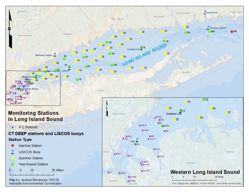
The Connecticut Department of Energy and Environmental Protection, with funding provided by the Long Island Sound Study, has been conducting the Long Island Sound Water Quality Monitoring Program since 1991. Surface and bottom waters are monitored by staff aboard the Department’s Research Vessel John Dempsey in the Sound’s eastern, central, and western basins. Testing parameters include water temperature, salinity, dissolved nitrogen, particulate nitrogen, water clarity, and dissolved oxygen. Information about the program is on the CT DEEP website. Water samples are collected year-round at 17 stations on a monthly basis, but from mid-June to mid-September every other week at 48 stations.
IEC Monitoring in the Narrows and Upper East River
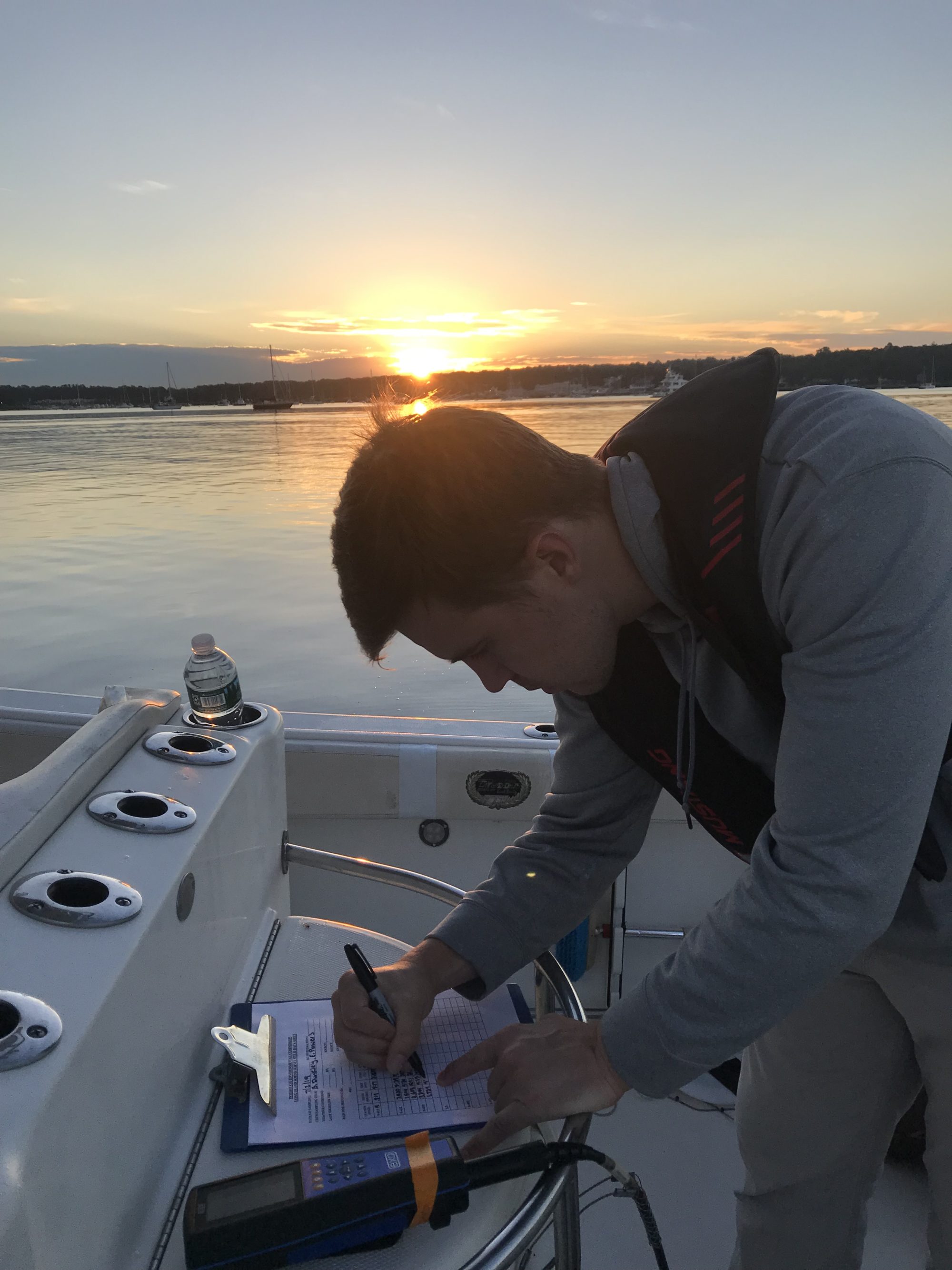
Since 1991, the Interstate Environmental Commission (IEC) has been conducting water quality sampling in support of the Long Island Sound Water Quality Monitoring program in the far western Long Island Sound (the Narrows) and its embayments and the Upper East River. Staff monitor dissolved oxygen (DO), as well as parameters that may influence DO since 1991. Over the years, the scope of the surveys has expanded to include additional stations and parameters to meet the needs and goals of Long Island Sound stakeholders. While historically this monitoring has been performed during the summer months, in 2018 IEC expanded these surveys year-round. During each survey, in situ measurements are taken for pH, temperature, salinity, DO, and Secchi disk depth. Surface samples are also collected bi-weekly for the analysis of chlorophyll a, TSS, BOD, and nutrients. IEC continues to produce a season summary with the Connecticut Department of Energy and Environmental Protection.
More information on the monitoring program can be found on the IEC website. IEC also posts the weekly summaries of the summer hypoxia monitoring in the publication section of its website.
Real-Time Monitoring on Long Island Sound Buoys
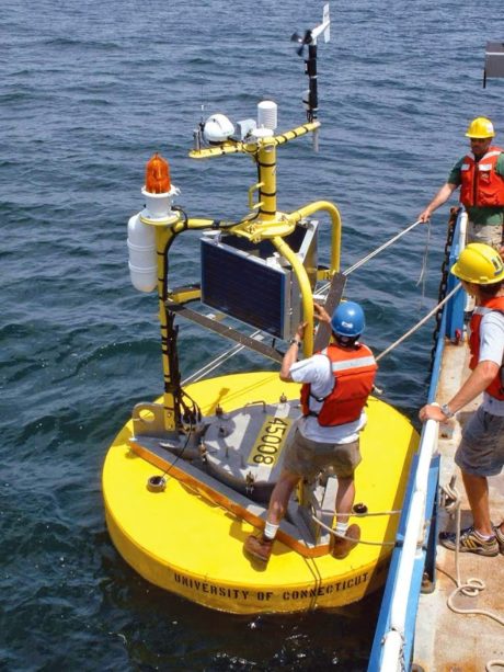
The Long Island Sound Integrated Coastal Observing System (LISICOS) was established in 2003 as a component of a regional/national ocean observing system. The system was conceptualized as part of a water quality monitoring program that combined the traditional ship-based point sampling surveys with continuous, real-time sampling stations. LISICOS continuously monitors in situ water quality parameters and meteorological parameters at up to eight stations across the Sound. Sensors are attached to a moored buoy at various depths (surface, mid, and bottom). Data are transmitted every 15 minutes in real-time via satellite where they are stored in a database and uploaded to the LISICOS website. The system is maintained by the University of Connecticut.
Other Water Quality Monitoring Programs
The Unified Water Study Samples the Sound’s Harbors and Bays
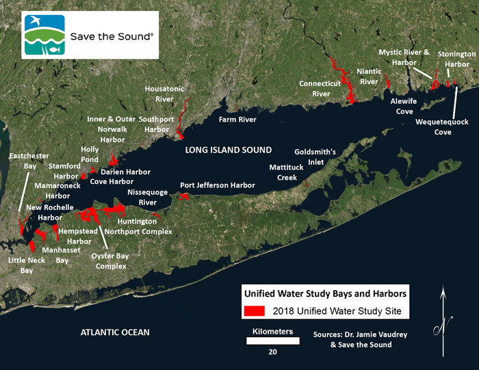
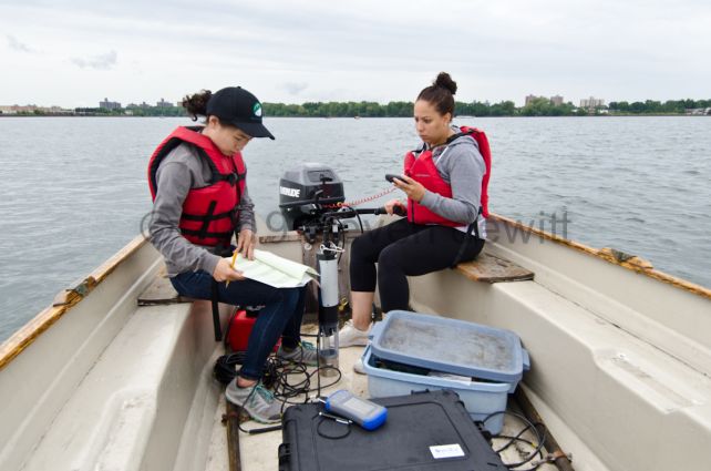
Historically, it’s been difficult to compare water quality conditions in the Sound’s many inlets because the monitoring work is conducted by different groups with different monitoring approaches. The Unified Water Study: Long Island Sound Embayment Research (UWS) is a new water quality monitoring protocol developed so groups around Long Island Sound can collect comparable data on the environmental health of our bays and harbors. Launched by Save the Sound in 2017, this groundbreaking water testing program will dramatically increase available data on the health of Long Island Sound. The findings will further our understanding of the Sound and inform and support our actions to preserve and protect it. The data collection is funded through the Long Island Sound Study. Learn more about the monitoring on the Save the Sound website.
USGS Monitors Streams and Rivers
The US Geological Survey conducts water quality monitoring in streams and rivers that connect to Long Island Sound, including the three rivers in Connecticut that supply about 90 percent of its freshwater – The Connecticut, Thames, and Housatonic Rivers. The Long Island Sound Study frequently provides grants to USGS to help fund stream monitoring programs and research. Visit the USGS New England and New York websites for more information.
Monitoring for Pathogens at Long Island Sound Beaches
In Long Island Sound, local health departments and state agencies test the water at 240 swimming beaches for disease-causing microorganisms. The most frequent sources of disease-causing microorganisms are sewage overflows, polluted stormwater runoff, sewage treatment plant malfunctions, boating wastes, and malfunctioning septic systems. Pollution in beach water most often occurs following heavy rain when older sewage systems that have combined stormwater and sewage systems overflow, and cause untreated sewage to flow into the Sound. The US EPA’s Beaches Website provides information on whether the water at a specific beach is being monitored, who is responsible for the monitoring, the pollutants that are being monitored, and if advisories or closures have been issued.
In 2015 Save the Sound launched Sound Health Explorer, a website that grades coastal beaches by looking at high bacterial counts that lead to beach closures and comparing them to national averages. Rainfall is also featured on the site, allowing users to see which beaches suffer from bacterial contamination as a result of polluted stormwater runoff or from very local sources of fecal pollution such as a leaking municipal sewer line.
New York City Harbor Water Quality Survey
New York City Department of Environmental Protection’s Harbor Water Quality Survey provides data on fecal coliform and enterococcus pathogens in the Upper East River and Western Long Island Sound that have been monitored by the NYCDEP as well as data for water quality indicators such as dissolved oxygen levels and concentrations of microscopic plants and animals. Information about the survey is on the NYCDEP website.
